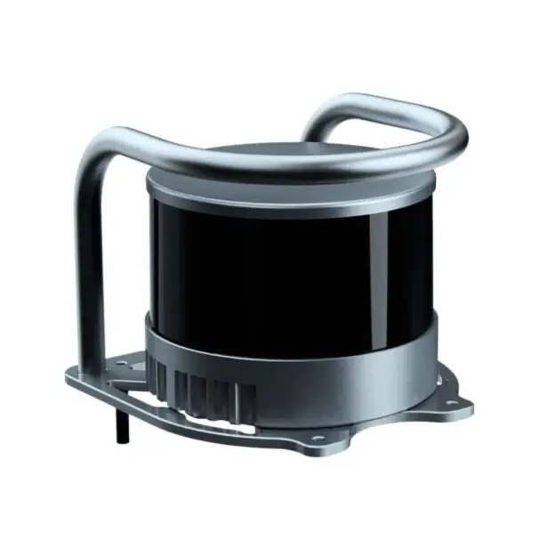
Unitree Go2 LiDAR XT16
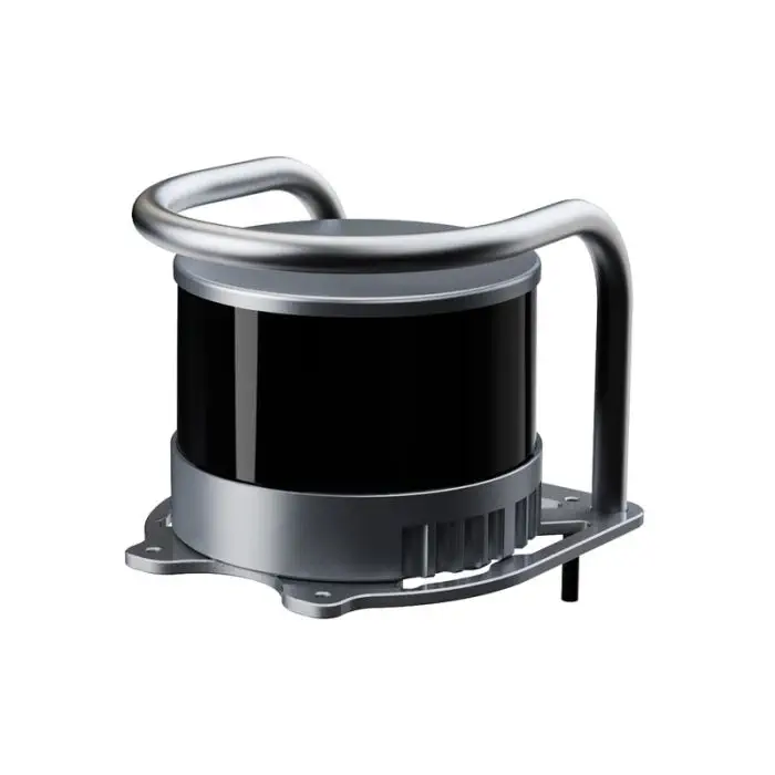
Unitree Go2 LiDAR XT16 — the Hesai PandarXT-16 16-channel mechanical rotating LiDAR as an official Go2 accessory: 0.05–120 m range, 360°×30° FOV, Go2 back mount with protective frame. Fits Go2 EDU, EDU Plus and Go2-W.
- 16-channel mechanical rotating LiDAR (Hesai PandarXT-16)
- 0.05–120 m range at ±1 cm accuracy, 320k/640k pts per second
- 360° × 30° field of view, 0.18° × 2° angular resolution
- Go2 back-mount bracket with protective frame included
- Fits Go2 EDU, Go2 EDU Plus and Go2-W
About the Unitree Go2 LiDAR XT16
The Unitree Go2 LiDAR XT16 is the 16-channel navigation sensor that gives a Go2 quadruped serious SLAM capability: a full 360° by 30° field of view, 120 metres of ranging and a dense point cloud that holds up in warehouses, corridors and outdoor sites. Built around the Hesai PandarXT-16 mechanical rotating LiDAR and delivered as an official Unitree accessory, the unitree go2 lidar xt16 arrives with a metal mounting bracket and protective frame that bolt onto the Go2's back — the same installation used on the factory-fitted EDU Plus and Go2-W Ultimate configurations.
Every Go2 already carries the built-in 4D LiDAR L1 for super-wide-angle obstacle avoidance. The Unitree Go2 LiDAR XT16 adds a different instrument: a survey-grade rotating sensor whose sixteen laser channels stack a vertical profile from -15° to +15°, so the robot maps walls, curbs and floor clutter in three dimensions instead of only detecting that something is there. Point rates reach 320,000 per second in single-return mode and 640,000 per second in dual-return mode, at 0.18° horizontal and 2° vertical angular resolution.
The Unitree Go2 LiDAR XT16 fits the Go2 EDU, the Go2 EDU Plus and the wheeled Go2-W — Unitree's own Go2-W developer documentation lists the XT16 alongside the MID-360 as a supported SLAM sensor for that platform, and the same sensor ships integrated on EDU Plus and Go2-W Ultimate robots. Setup is mechanical first: mount the bracket, seat the sensor in its protective frame, and connect power and data — the sensor runs on a wide 9–36 V DC input, so no separate supply is needed.
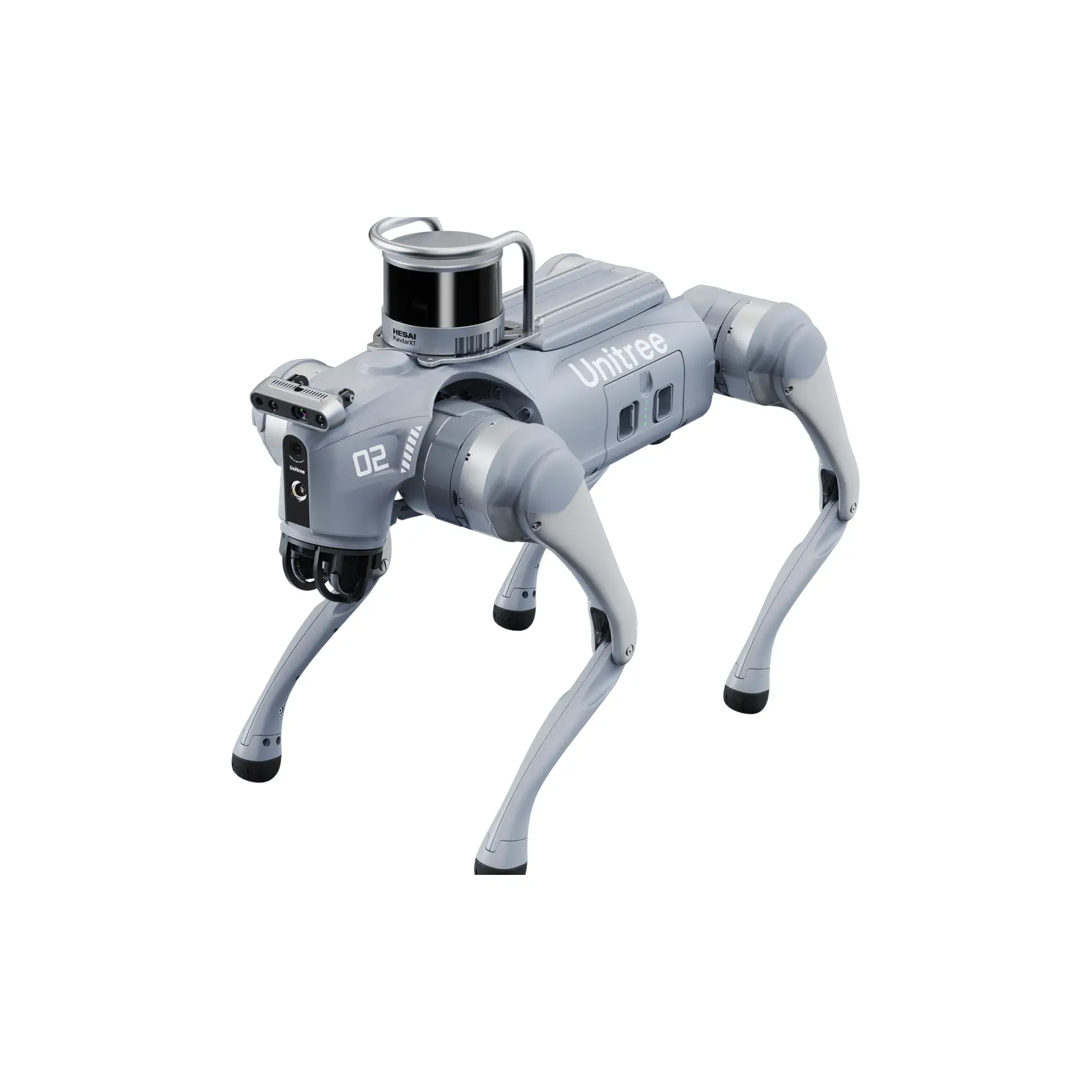
Three LiDARs, Three Jobs — Where the XT16 Fits
A Go2 can carry three different laser sensors, and they are not interchangeable. The built-in 4D LiDAR L1 comes with every Go2 and watches for obstacles in a super-wide 360° × 90° sweep. The MID-360 is a compact solid-state navigation sensor. The unitree go2 lidar xt16 is the mapping-grade option: a Hesai 16-channel rotating LiDAR that builds dense 3D maps for SLAM. If you are extending a Go2 EDU's perception stack, pair it with the high computing power module to process the point cloud on board.
What the Unitree Go2 LiDAR XT16 Adds to Your Go2
Navigation splits into two jobs: noticing obstacles, and knowing where you are. The Go2's built-in 4D LiDAR L1 handles the first job across a super-wide 360° × 90° field, which is why the robot dodges a kicked box before it touches a leg. The Unitree Go2 LiDAR XT16 is built for the second job. Its sixteen channels rotate through a full 360° horizontal circle while stepping vertically from -15° to +15°, stacking a three-dimensional profile of the world at 320,000 points per second — 640,000 in dual-return mode, where the second echo catches what the first pulse passes through.
That vertical profile is what separates a map from a detection. A single-plane sensor sees a wall and a curb as the same kind of event; the unitree go2 lidar xt16 sees the wall's face, the curb's edge and the floor plane between them, which is the input SLAM algorithms need to localise a robot in a warehouse aisle or an outdoor yard. At 0.18° horizontal angular resolution, features stay separated at distance — the sensor keeps resolving structure tens of metres out, up to its 120 m maximum range.
The hardware is built for robot duty rather than a surveyor's tripod: IP6K7 sealing against dust and driving water, a Class 1 eye-safe 905 nm laser, a 9–36 V DC input that runs straight off the robot, and a protective frame around the rotating head. Mounted on the Go2's back with the included bracket, it adds roughly 800 g to the payload — in the same class as the spare battery that is already standard kit on EDU deployments.
Which Go2 Models Does the Unitree Go2 LiDAR XT16 Fit?
The Unitree Go2 LiDAR XT16 fits three Go2 platforms. On the Go2 EDU and Go2 EDU Plus it is the standard navigation upgrade — the EDU Plus ships from the factory with this exact sensor installed on the same back-mount bracket included here. On the wheeled Go2-W, Unitree's developer documentation lists the XT16 alongside the MID-360 as a supported SLAM sensor, and the Go2-W Ultimate carries it integrated from the factory.
If you run a Go2 Air or Go2 Pro, ask us to confirm fit for your robot before ordering — mounting and software differ across the range, and we would rather check your exact configuration than guess.
- Unitree Go2 EDU — supported navigation upgrade
- Unitree Go2 EDU Plus — factory-fitted with the same sensor and bracket
- Unitree Go2-W — supported SLAM sensor per Unitree developer documentation
- Go2 Air / Pro — ask us to confirm fit for your robot before ordering
Specifications
| Type | 16-channel mechanical rotating LiDAR (Hesai PandarXT-16) |
| Ranging distance | 0.05 – 120 m |
| Accuracy | ±1 cm (0.5 cm 1σ precision) |
| Point rate | 320,000 pts/s single return; 640,000 pts/s dual return |
| Field of view | 360° horizontal × 30° vertical (-15° to +15°) |
| Angular resolution | 0.18° (H) × 2° (V) |
| Dimensions | Φ103 × 76 mm |
| Weight | ≈800 g |
| Protection / laser | IP6K7; 905 nm, Class 1 eye-safe |
| Power input | 9–36 V DC |
| In the box | 1 × XT16 LiDAR sensor in protective frame · 1 × Go2 back mounting bracket |
Shipping & Sensor Care
Every unitree go2 lidar xt16 is 100% quality-inspected before it ships, so it arrives in perfect working order. The sensor is a precision optical instrument: we ship it in rigid, shock-absorbing packaging with the rotating head locked, and the sealed IP6K7 housing means no maintenance routine beyond keeping the optical window clean and dry.
Store the sensor in its protective frame, avoid touching the optical window, and let any condensation dry at room temperature before powering it up. A spare Go2 battery or charger travels in the same parcel if you are stocking up for a deployment.
Last updated: September 2026.
Frequently Asked Questions
Can't find what you're looking for? Contact our